
Apache Junction ZIP Coverage
Five current 851-series ZIPs are tied to the Apache Junction postal area in the official 2009 conversion record. Their roles are not the same. Two are principal street-delivery codes, one is for post-office boxes, and two extend through territory that must be checked address by address. The Apache Junction ZIP code directory begins with documented postal use rather than guessed neighborhood borders.
| ZIP | Supported area or use | Postal relationship | Search caution |
|---|---|---|---|
| 85117 | Apache Junction PO boxes | Apache Junction Main Office | A box does not identify a home |
| 85118 | Eastern postal area toward Gold Canyon | Apache Junction Main Office | Postal area differs from city limits |
| 85119 | Central and eastern street delivery | Apache Junction Main Office | Check parcel jurisdiction |
| 85120 | Western street delivery | Apache Junction Main Office | Approaches the county line |
| 85178 | Special delivery territory | Apache Junction Main Office | Verify each address through USPS |
The source-supported set does not include 85190. That code belongs to Tortilla Flat even though the federal notice ties it to Apache Junction postal operations. No official source established precise neighborhood prose for each boundary. Use a local GIS polygon and the postal lookup for exact claims.
Street-delivery and box codes also call for different methods. A street-delivery result can be compared with a parcel and municipal boundary. A box code only says that mail is collected at the post office. It provides no sound path to a residence, parcel, or block. That practical split is why the use column matters as much as the five digits.
Apache Junction ZIPs Changed in 2009
A major numbering shift can hide older Apache Junction records. On July 1, 2009, USPS changed the affected Pinal County prefix from 852 to 851. The old codes 85217, 85218, 85219, 85220, and 85278 became 85117, 85118, 85119, 85120, and 85178. The federal notice listed 2,949 converted deliveries for 85178 and 14,913 for 85120. Those are deliveries, not residents.
The USPS Postal Bulletin conversion table is the dated source for this Apache Junction ZIP code history. Its captured official record shows the conversion details:
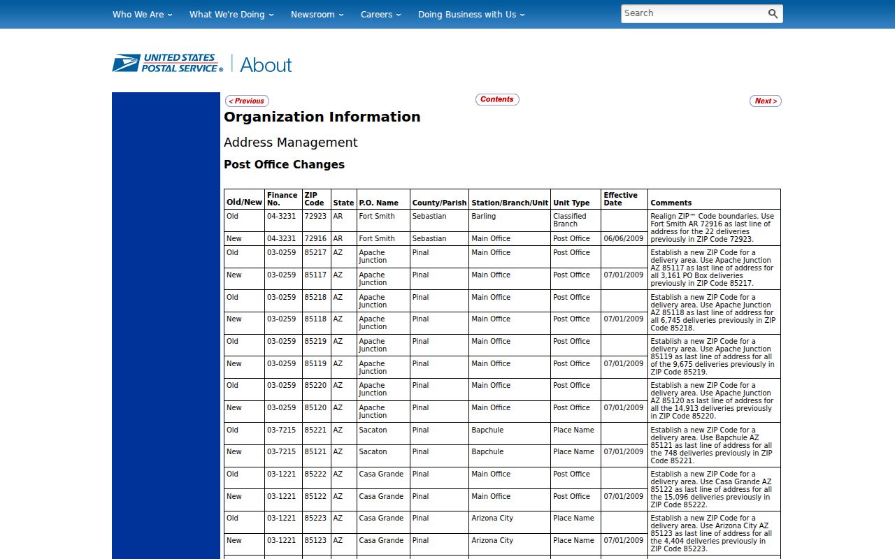
An obituary, old directory, deed mailing line, or newspaper notice created before the change may retain an 852 code. Search both versions when following one address through time. The street and parcel may not have changed.
The official boundary map for the same change is useful when a 2009-era source is unclear. Current delivery, however, should still be checked in the live USPS tool. Postal history can explain why two documents show different last lines, but it cannot prove that the named person occupied the site on either date.
Search Apache Junction Residents by ZIP
A postal code narrows a large search, but no official portal offers a public household list. The useful sequence checks delivery, situs, and ownership in turn. Each source answers a smaller question and leaves occupancy unproved.
- Validate the full address in the official USPS lookup. Record the current code and ZIP+4 when returned.
- Compare it with Apache Junction GIS. Confirm the mapped ZIP, full address, parcel number, and county.
- Search the exact street address through the Pinal Assessor, then review the Treasurer's owner mailing fields.
- Keep the parcel ZIP separate from the owner's mailing ZIP before narrowing to a street.
The USPS ZIP Code Lookup supplies the first official check. Its captured interface belongs in this Apache Junction ZIP code directory workflow:
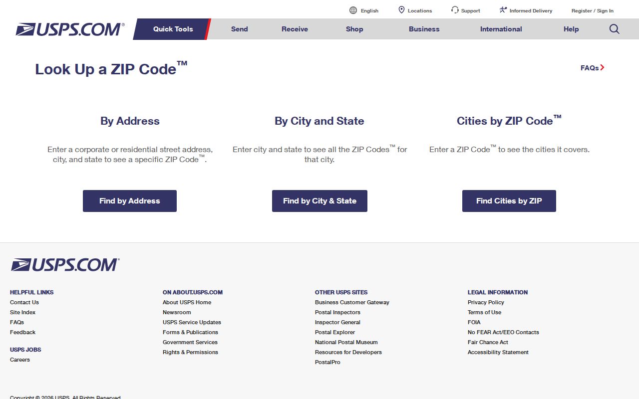
Once the postal area is reduced to a road, the Apache Junction street directory continues with address-level sources. This prevents a ZIP-wide owner list from being mistaken for a resident roll.
The Assessor itself does not expose a ZIP field on the inspected search form. Its property route needs street number, direction, name, and suffix. The Treasurer accepts a mailing ZIP, while city GIS carries a situs ZIP. Keeping those two fields labeled avoids one of the most common false matches in Apache Junction ZIP code directory work.
Apache Junction ZIP Boundary GIS
City GIS stores an address in parts: number, direction, street name, suffix, building, unit type, unit, city, county, state, and ZIP. It then creates a full address. Parcel Number links that civic address to county land records. This local model is more precise than a mailing label and helps when a unit or directional prefix is unclear.
The Apache Junction GIS ZIP query exposes the official polygon layer and its controls:
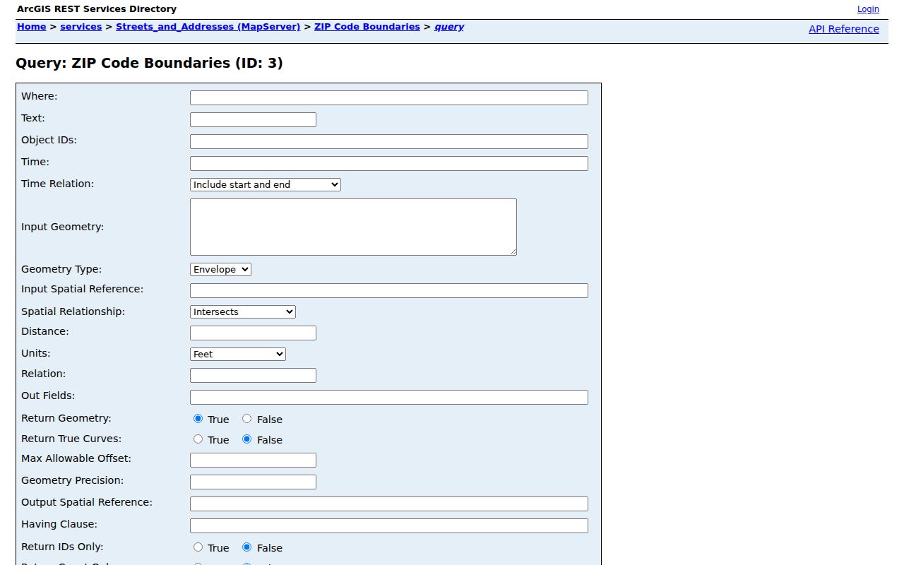
The service accepts text, object ID, geometry, spatial relationship, distance, output-field, and format settings. It is a technical endpoint, not a people directory. Use it to test which polygon contains a parcel, not to claim a complete resident export.
| GIS control | Use in a ZIP check |
|---|---|
| Where or text | Selects a known layer value |
| Input geometry | Tests a point or mapped shape |
| Spatial relationship | Checks whether a point intersects a polygon |
| Output fields | Returns only the needed layer data |
Apache Junction ZIPs Versus City Limits
ZIP geography routes mail. The city boundary determines municipal jurisdiction. Pinal and Maricopa county lines determine which county keeps a parcel record. All three shapes can differ. An Apache Junction last line may sit outside the incorporated city, and the far western area calls for a parcel-level county check. Most local property work belongs in Pinal County, but the city name cannot settle custody by itself.
A large public-land footprint creates another trap. The city covers about 35 square miles, while its general plan described about 22 square miles as state or federal land not then under active development. A postal polygon is not a run of settled blocks. Census ZIP Code Tabulation Areas are statistical approximations, not USPS delivery borders.
- ZIP code
- A five-digit USPS routing area, not a city boundary.
- ZIP+4
- A nine-digit code that narrows delivery to a smaller segment.
- PO-box ZIP
- A code used for boxes at a post office rather than mapped homes.
- Carrier route
- A mail sequence within a postal area, not a resident list.
Boundary check. Confirm the postal code with USPS, the city line with Apache Junction GIS, and the county through the parcel record.
ZIP Fields in Pinal Records
The Pinal County Treasurer has the strongest ZIP-capable property search documented in the research. Its owner and mailing-address form accepts partial values. Results can be exported to CSV and show parcel number, owner, mailing city, state or province, and postal code. The database updates nightly.
| Search field | Input | What it narrows | Limit |
|---|---|---|---|
| Owner Name | Last, first, or business | Tax-account holder | Not occupancy |
| Address | Partial mailing address | Contact destination | May differ from parcel |
| City | Mailing city | Rows mailed there | Not situs city |
| Zipcode/Postal Code | Five-digit or partial | Mailing ZIP rows | Not situs ZIP |
| Tax Year | Year | Tax cycle | Nightly update |
The Pinal Treasurer Parcel Inquiry capture shows the official tax and mailing route used for ZIP narrowing:
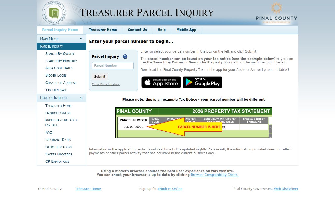
A query for 85119 can find owners receiving tax mail there for land elsewhere. It can miss a parcel in 85119 whose owner receives mail in another state. The mismatch is a clue, not an error.
Reading Apache Junction ZIP Counts
The Arizona Office of Economic Opportunity listed ZCTA populations of 21,219 for 85119 and 28,168 for 85120 in its inspected table. Those values must not be added and called Apache Junction's population. A ZCTA is a Census approximation to a postal area. It can extend beyond city limits, while the incorporated city has its own count.
Postal delivery totals answer another question. Property-query rows count tax accounts. Neither measure equals the number of people at an address. The Apache Junction ZIP code directory keeps each number tied to its source so that a large total does not become a false resident estimate.
Seasonal use makes care even more important. A city survey counted large shares of manufactured or mobile homes and park-model or RV units. Parcel ownership, winter occupancy, and postal delivery may point to different people at different times.
Apache Junction ZIP Address Clues
City GIS separates direction and suffix from the street-name stem. The official map labels Meridian Drive, Ironwood Drive, Idaho Road, Tomahawk Road, Mountain View Road, Goldfield Road, Elliot Avenue, and Ray Road. Research did not establish a mathematical address-origin rule, so copy the directional field as shown instead of assuming a grid.
County searches offer other routes when a postal address fails. The Assessor accepts Book-Map-Parcel, subdivision, section-township-range, and cabinet-slide-lot. These keys follow the land rather than a changed postal code. A deed's legal description also remains useful after the 2009 shift.
Note: A parcel number or recorded plat is the steadier bridge when old and current Apache Junction address forms do not match.
Apache Junction ZIP Directory Limits
Arizona's voter self-lookup confirms the requester's own registration and election details. It is not a ZIP-wide browser. Voter lists are limited to purposes authorized by A.R.S. §16-168, and unlawful internet reposting is forbidden. Protected voters and Address Confidentiality Program participants may have address data sealed or substituted.
Property tools show owners and mailing destinations, not everyone in a home. A post-office box cannot be translated into a dwelling through 85117. Utility customer data is not a substitute, and public GIS has no household names. These limits are part of an accurate ZIP code directory, not gaps to fill with guesses.
Use ZIP evidence for family history, civic research, and lawful address verification. Confirm a result with its custodian, especially when names repeat or city, county, and postal geography disagree.